Explore The Trail
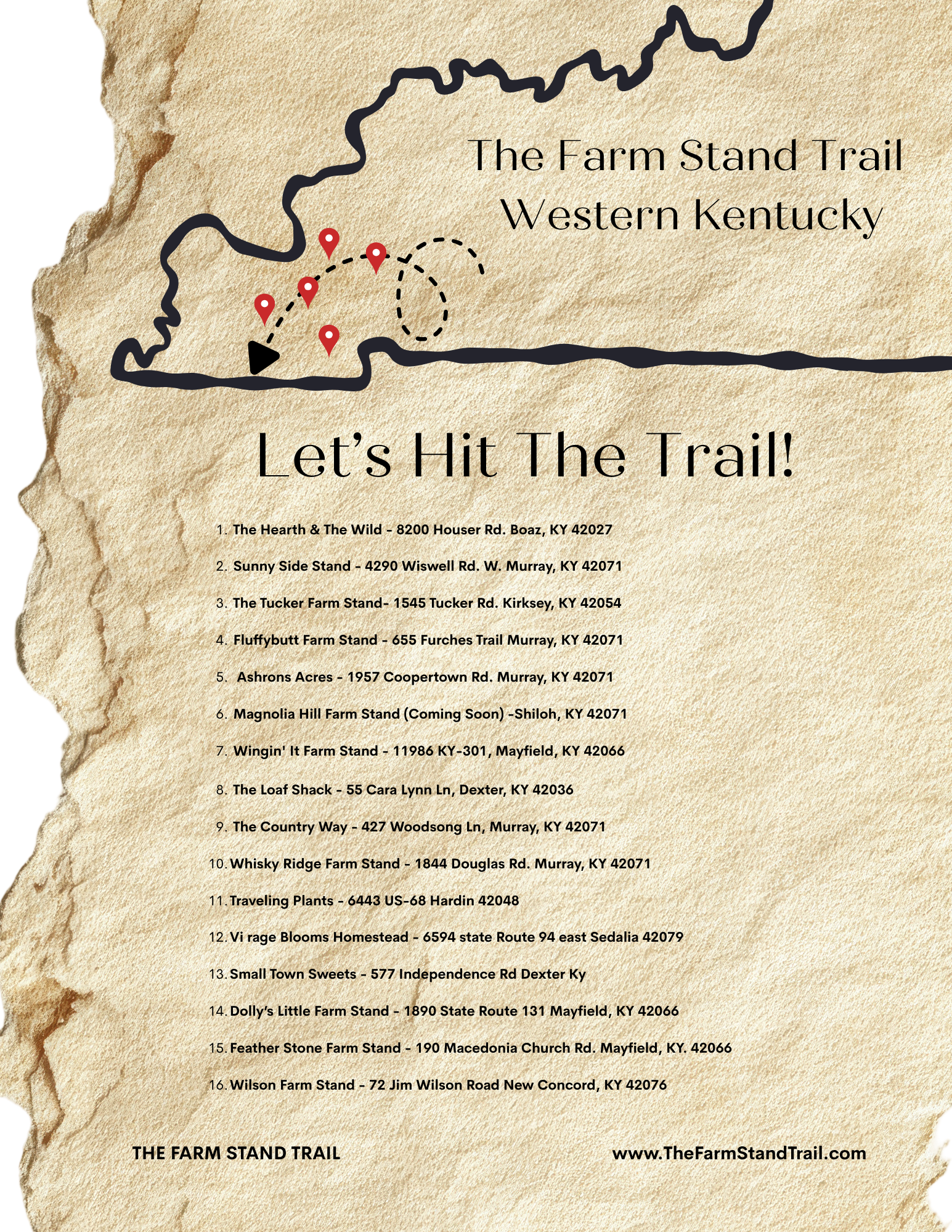
Use the numbered PDF Guide to follow the trail. Tap each location on the map above to see what’s available, hours, and more details along the way.
ABOUT
Nestled between lakes and winding backroads, this region has long been a place of quiet beauty, small farms, and roadside stands. The Farm Stand Trail is a simple way to experience it - one stop at a time.
Bookmark This Page: Use the interactive map to explore farm stand locations in real time, or download the printable version to take with you on your drive.
Each stop is numbered so you can easily follow along - whether you’re planning your route ahead of time or discovering along the way.